 ]]>
]]>
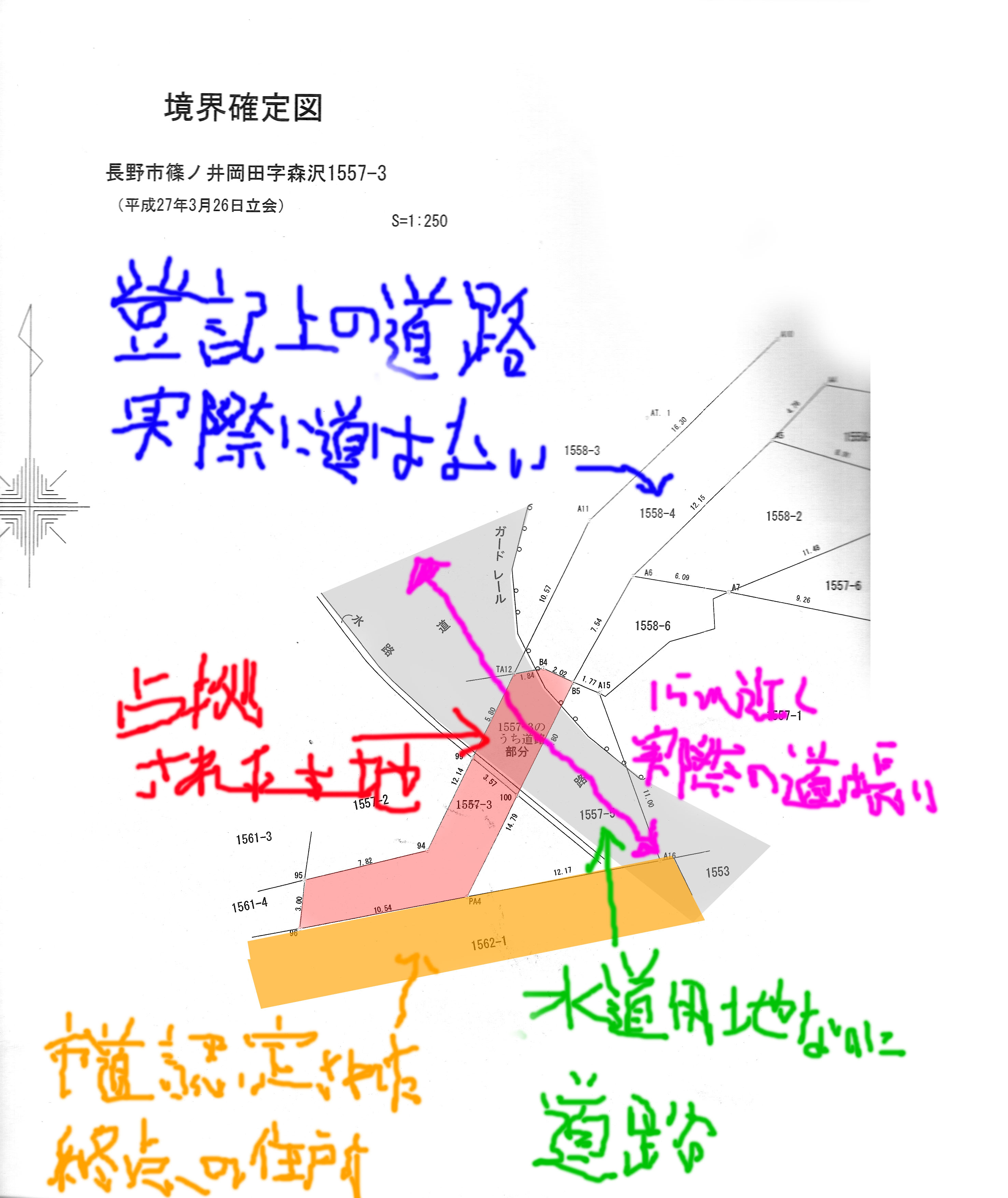
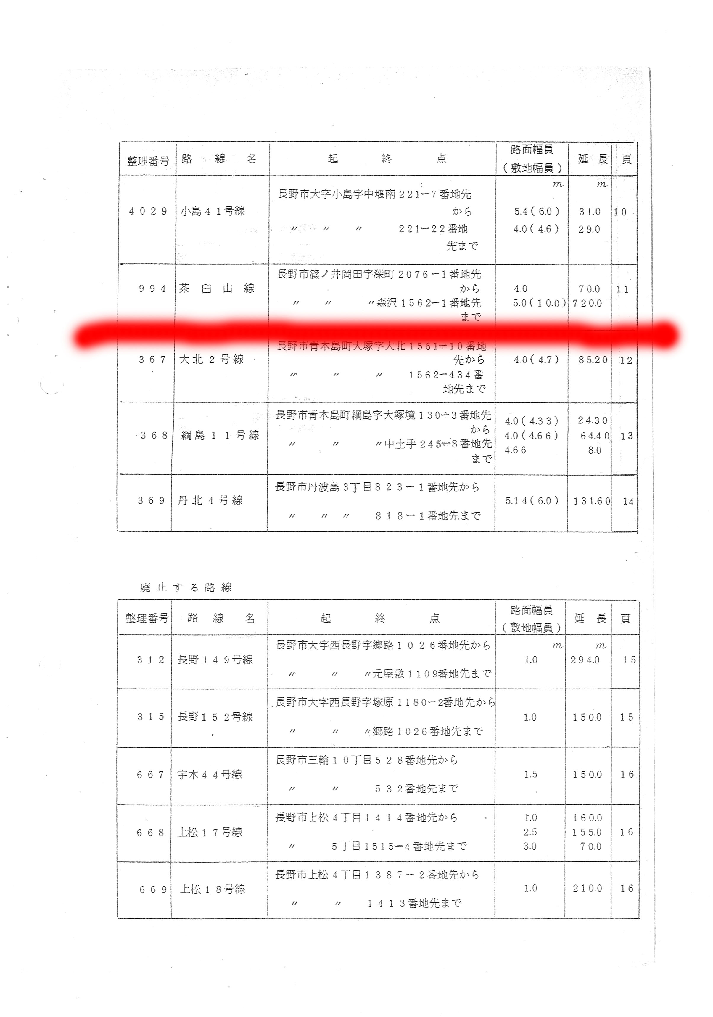
長野市篠ノ井岡田字森沢1561-4番地につきまして、市道ではないとのことですが、資産税課では公衆用道路の扱いになっている様だと説明をうけました。これについて調査の上で回答願います。
]]>
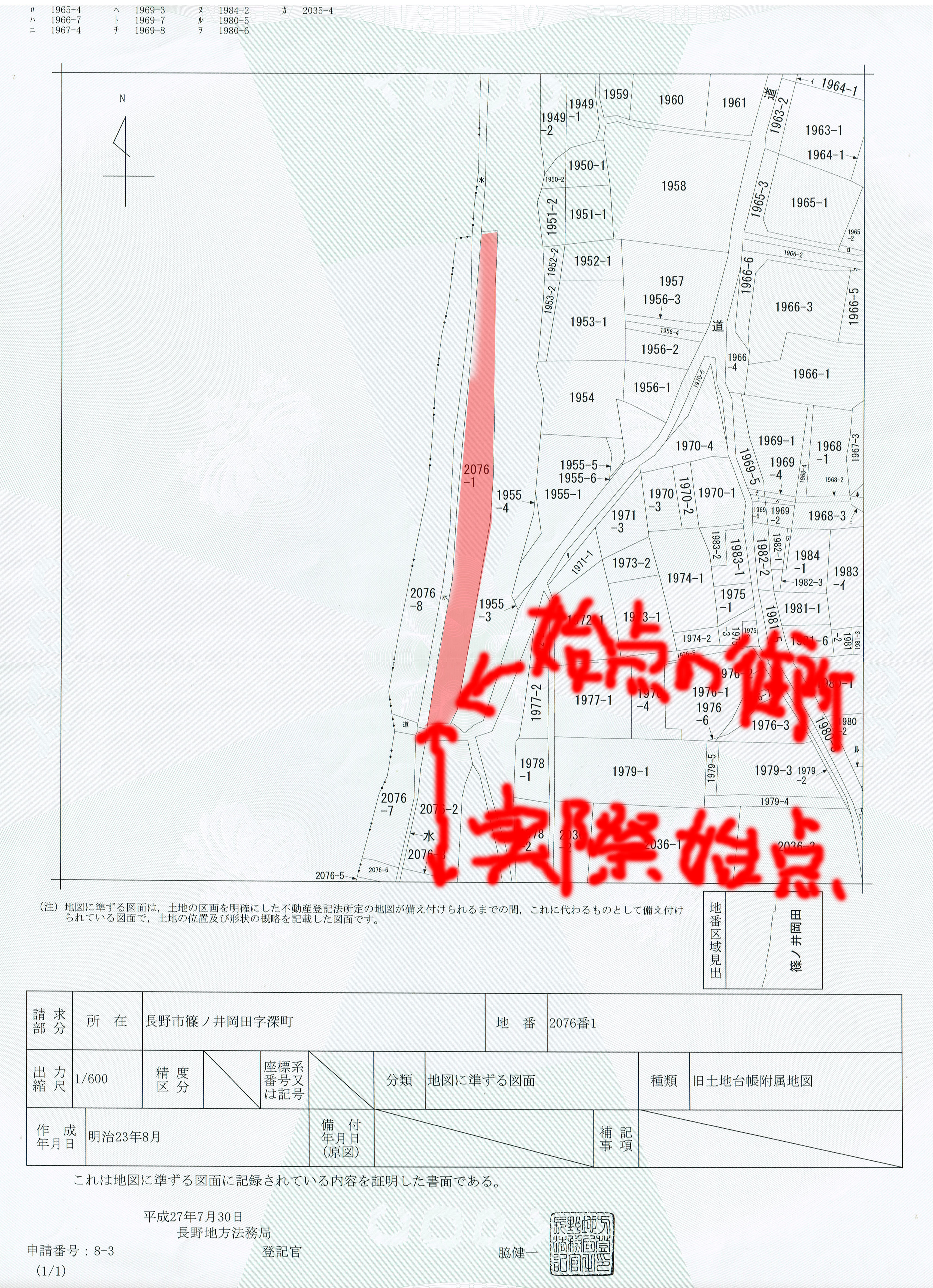
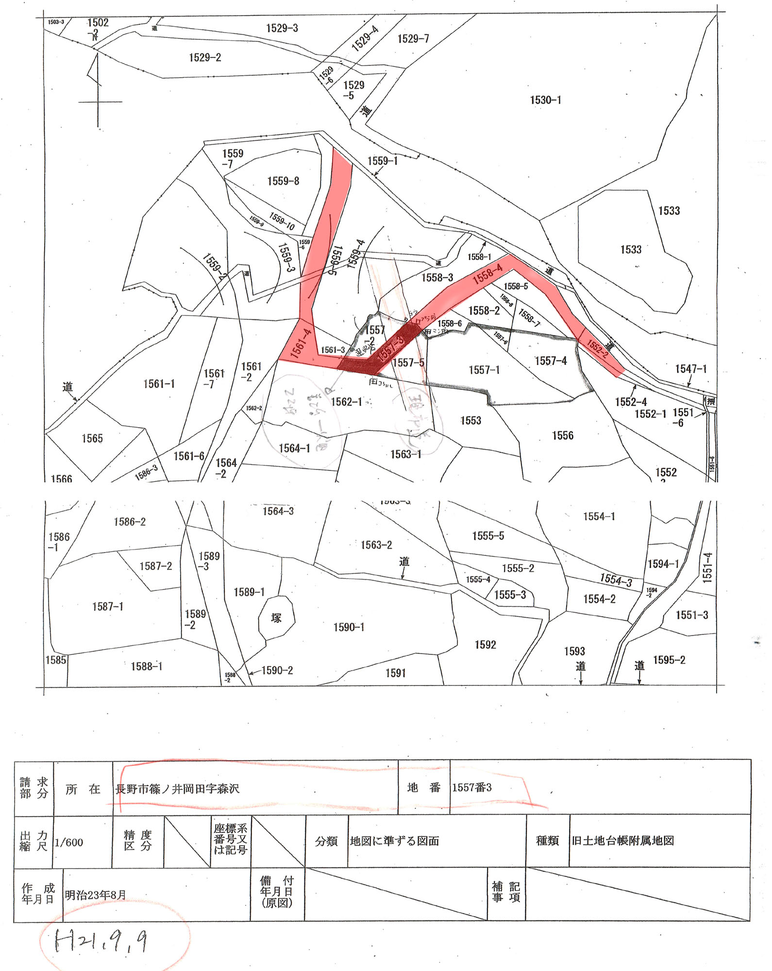
登記所にある公図。基本は 明治23年のままである。昭和30年ごろに行われた分筆等の住所は記載されている。赤い部分は、昭和30年以前にあった道路と水路に、一致していると思われる土地。
昭和34年頃の宇土沢川の付け替え工事により、道筋が変わる。それ以降、公図の境界と、現状の道路の形状は一致していない。
長野市は、古い文書は廃棄しており、資料がほとんどないと説明。付け替え工事の記録は見つかっていない。合わせて、土地が返還された記録がない。道路ではないにもかかわらず、公衆用道路の課税地目のままになっていたようである。
登記簿上は、道路の記載がなく、畑となっている。課税地目は、コンピューターの導入された昭和58年以前から、全面積が公衆用道路として扱われていたとのこと。この処置により、財産目録から除外されていたため、認知が遅れた。この事は、昭和54年に用地買収の説明が無かったことの証明でもある。
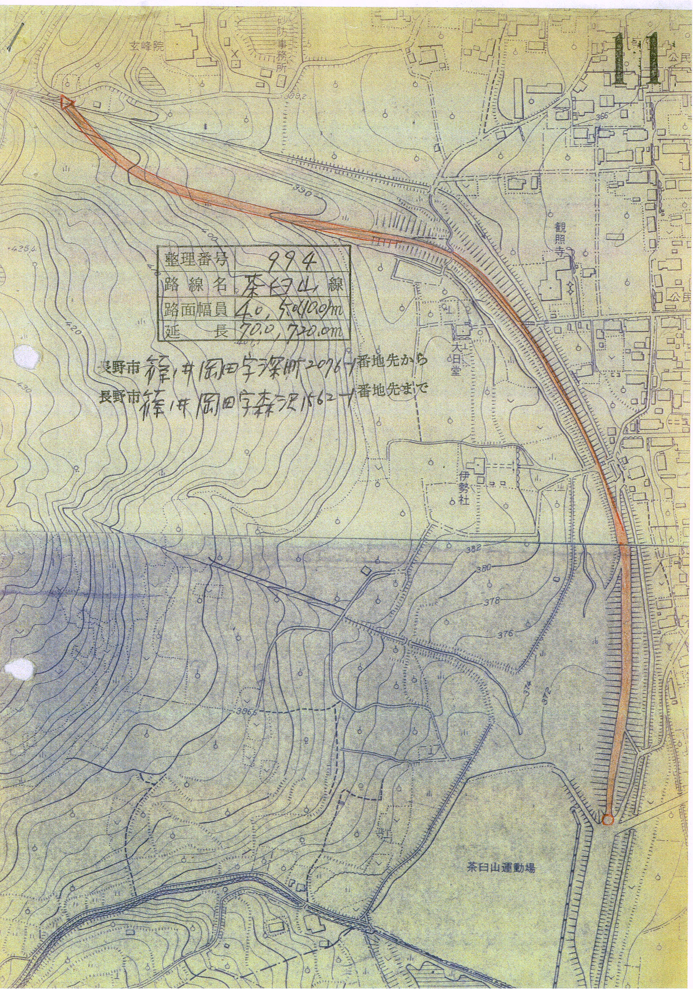
昭和34年ごろ、宇土沢川の付け替え工事により、道の形状がかわりました。 昭和54年に新たな道路ができ、市道認定される。
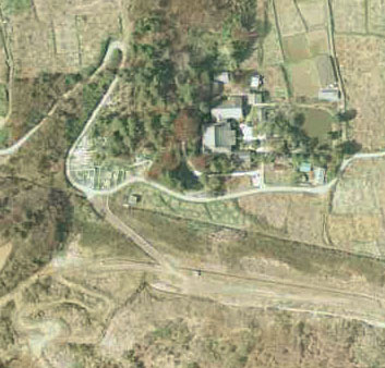
昭和21年の航空写真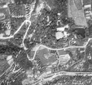
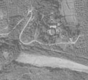
昭和40年の航空写真
昭和51年の航空写真